07.08.2019: Cold front over Southern and Central Germany
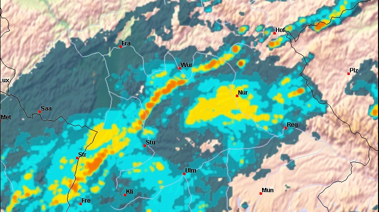
On 07.08.2019 a cold front crossed the south of Germany at noon. Within the compact, closed clouds of this front there was a linear development of precipitation.
The radar image shows this line excellently. Only few gaps promise a dry flight through this front.
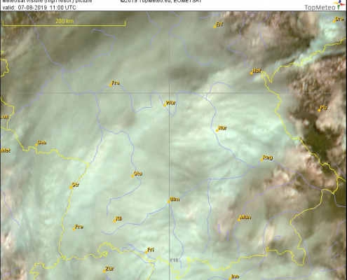
If you overlay the satellite image, with a bit of good will you can still see this linear characteristic of the showers and thunderstorms.
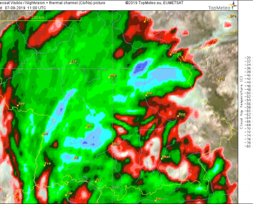
In the satellite image with temperature information, however, the line is no longer visible, except for the spot at the Erzgebirge which is still free of cirrus clouds.
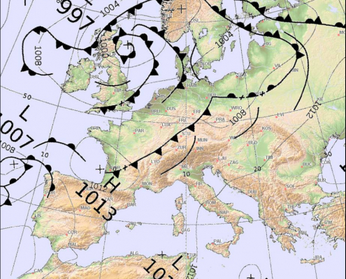
And in the surface analysis the cold front clearly belongs to a small low pressure area, which was located with its center near Berlin and which belongs to a trough, whose controlling low had found its way over Scotland for a whiskey.


 Bernd Goretzki
Eintrag teilen