Interview with Dr Bernd Goretzki: champion d’Europe OLC
Bernd, co-founder TopMeteo is OLC-plus competition European champion. In 2020, he scored 7,078.17 points in six flights, with the “shortest” flight being more than 1,100 km. And all this in Europe. Let’s see what he has to tell us about this year’s flights.
Congratulations on your OLC European Championship title! Can you tell us a bit more about your best flight this year?
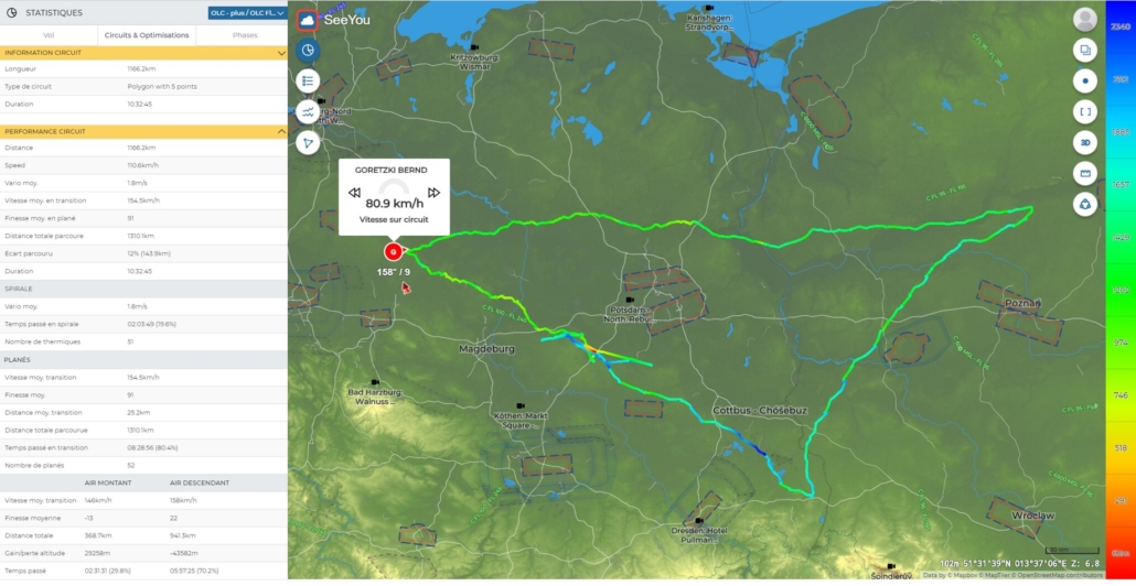
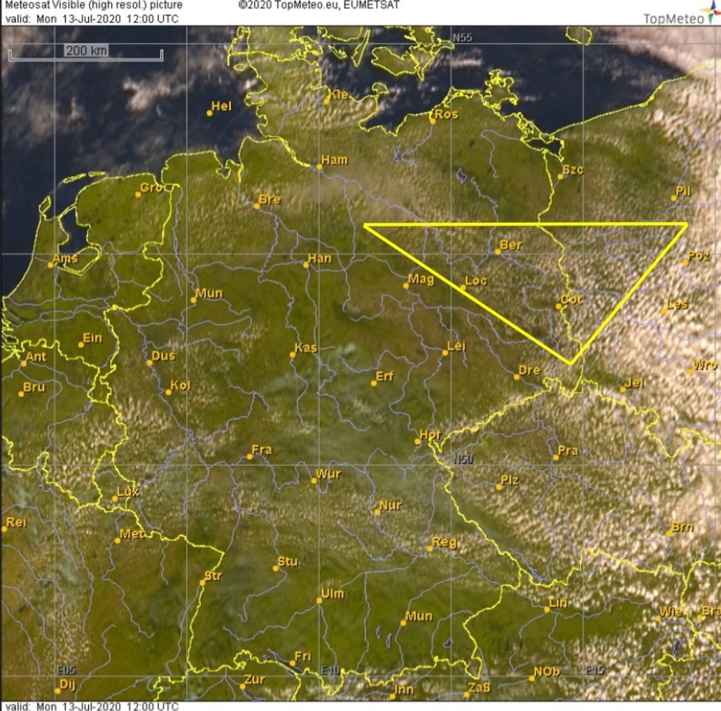
Bernd: Thank you very much. Five of the six flights that were included in the ranking were flown in Spain. But surprisingly, the flight with the highest points was in Germany. And this day did not look like a typical 1000K day at the beginning. But let’s get back to that… I should probably tell you first that my business partner Jon Meis and I had been waiting for a longer time to fly together in Fläming for a few days in a row and then discuss the flights from a meteorological point of view each evening. At the beginning of July, on 8th or 9th of July to be precise, the time had come and the forecasts offered the prospect that it might be worthwhile for Jon to set off from the edge of the Alps towards Berlin. The three days of July, 11, 12 and 13 were very similar meteorologically and promised pure flying fun. High pressure was found over central Germany, without moving much, and shovelled fresh, initially somewhat humid air from the North Sea into the country every day. For us in the eastern part of Germany, this meant that we could start early and the days were long. In fact, I was lucky to bring home 1000K three times in a row, which is certainly not typical for the region of Germany. Now to the day itself: It actually didn’t start fast. The cloud base was over 1000 m high from the start, but the climbs was hard to centre. We went northwest against the wind, which didn’t make things any better. So we decided to turn around and fly downwind when the visibility got worse and it almost smelled like North Sea. And since circling didn’t work, we decided to do only if really necessary. It’s amazing how fast you can sometimes be, with moderate cruising speeds, when your flight path is supported by organized, weakly ascending air like in cloud streets. In Poland the air mass changed, it became clear and then it worked. In the end, it was 1,160 km.
Five of your best flights came from Spain. Guy Bechtold, European vice-champion, also had his best flight there at the same time. How was it to fly there?
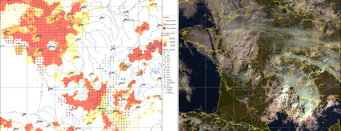
Bernd: Apropos Guy. In Spain, I was very lucky to fly with Guy. That’s how we got to know each other many years ago. And to be honest, he actually owns title and honour. In Spain you can learn so much from Guy. He knows his way around there like the back of his hand. The great thing was that we tried something new for me, every day. Above all, I wanted to get to know new areas, even if the weather there was perhaps not quite so great. So we could have a look at the Atlantic Ocean or fly as far south from Madrid as I had never been before. And the fact that we were able to score a lot of points in the process was a lucky circumstance. Of course, a good forecast is also part of it, as well as the reception of satellite images in flight. As you know, we produce the pictures ourselves and have optimised them, as far as possible, for good readability in the cockpit in full sunlight. At the moment we are optimising the transmission of the data. I cannot wait for everybody to see that.
The weather itself in Spain is usually fundamentally different from what I’m used to when flying long distances in Germany. It starts later in the morning and tougher. You have to be patient. But in the evening it takes longer and the sunset is actually sometimes the limiting factor. At least for Guy, who enjoys every minute. But the weather this year was definitely above average. There were many days that allowed distances of over 1,000 km or brought paradisiacal conditions for speed enthusiasts.
near Portugal 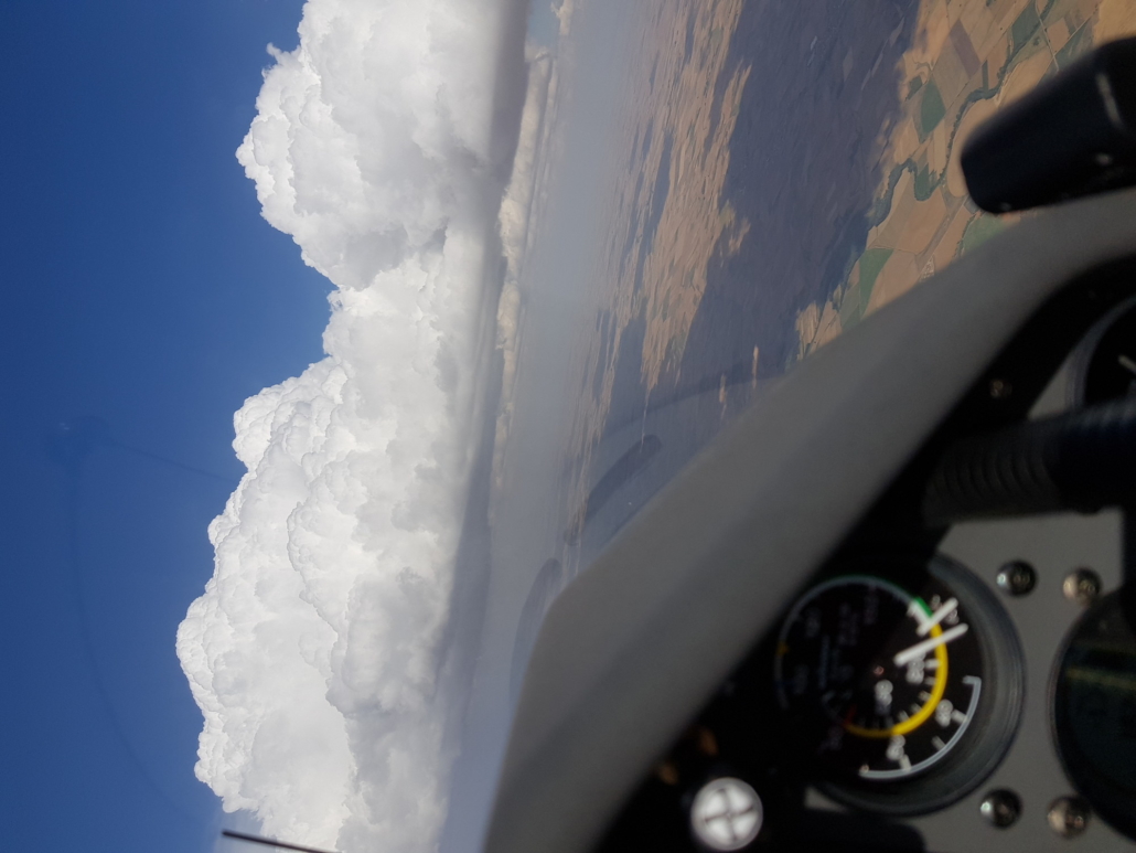
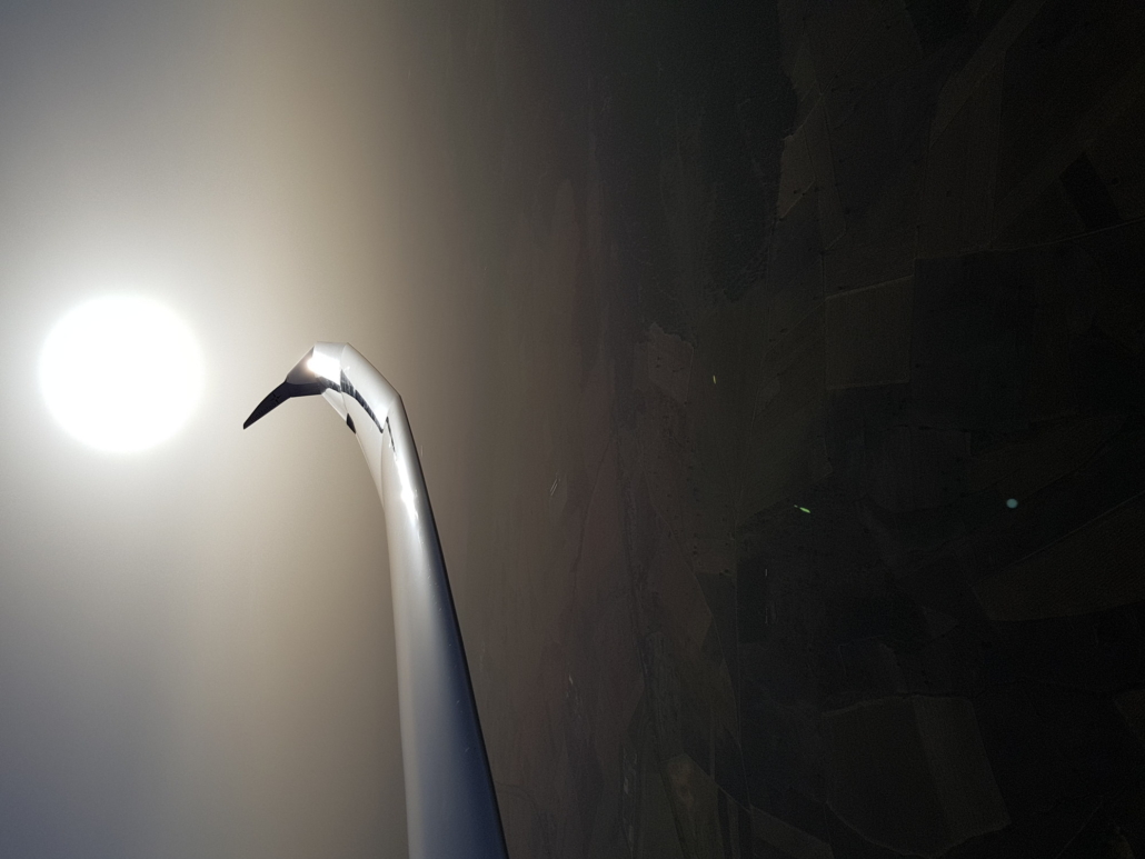
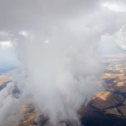
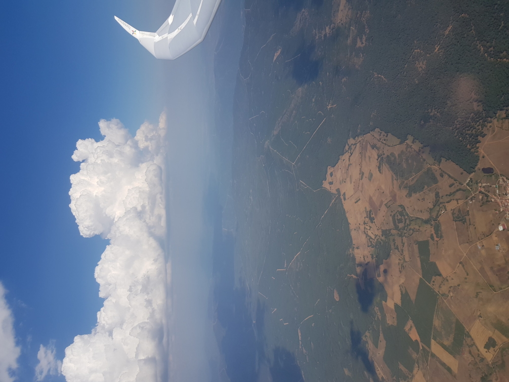
Dust from the Sahara 
riding the convergence near Teruel
You are often going a week or two to Spain for flying. How is it to fly there (airport, airspace, terrain, outlanding) ? Do you have any advice for pilots who would like to go there?
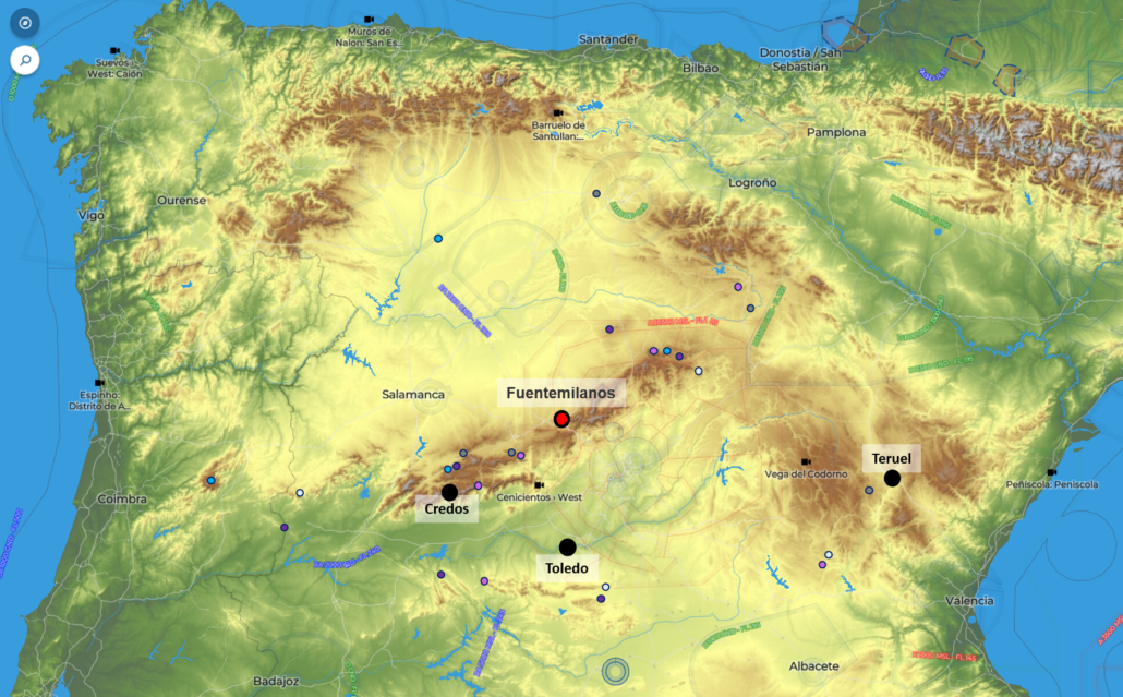
Well, I only can recommend Spain. Fuentemilanos airfield is north of Madrid and at greater altitude, so it doesn’t get quite so hot. Towing and accommodation are no problem, maybe you have to drive a little bit. Even in Corona times everything went very smoothly. But the Spanish are extremely careful and so there were sometimes long queues for restaurants. The neighbouring airfield Villacastin is more tranquil. But both places are equally well situated on the race track, which regularly manifests itself as a convergence line north of or above the mountains. There are more areas with convergence lines, for example in the east near Teruel or south of Madrid in the Toledo mountains. So it is not boring. There are also the Gredos, where the mountain peaks reach over 2500 m. Outlanding is possible almost everywhere without problems, but you have to be a bit careful in the direction of Portugal and in mountainous regions. You also have to be careful with the airspace. North of Madrid this is sometimes disturbing or let’s say better, it could be nicer.