The lee waves – just in time for the 2022 season. For Central Europe and in various altitude levels.
Short video on how to use the waves on the website:
Lee Waves & Slope Wind
The lee wave maps are available in four forecast altitudes.
FL70
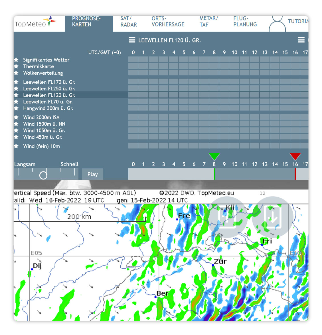
FL120
FL170
FL250
The slope wind is calculated at 300 m above ground.
Some facts
The large-scale vertical velocity in the model is shown. The forecast data originate thankfully from the DWD and are further processed, e.g. temporally filtered, so that mainly stationary structures become visible. Vertical movements in showers or fronts are mostly suppressed. The values also represent the maximum up- and down drafts in a broader altitude band, e.g. FL70 stands for the band 1500-3000 m, FL120 for 3000-4500 m and so on.
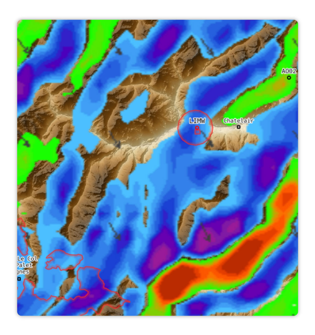
Slope winds shows the vertical movement close to the model orography. We have chosen about 300 m above ground as altitude. The model orography is of course still quite coarse compared to the real orography.
Wind arrows show direction and speed. Below 10 kt they are hidden.
Maps are prepared for areas which are covered to a large extent by the model, e.g. Alps, Germany, Czech Republic.
Forecasts are recalculated every 3 hours for 48 hours in advance. Start dates are 00 UTC, 03 UTC, … etc. Approx. 2-3 hours later the maps are available. Maps of the 09 UTC run, for example, are finished around 11-12 o’clock UTC.
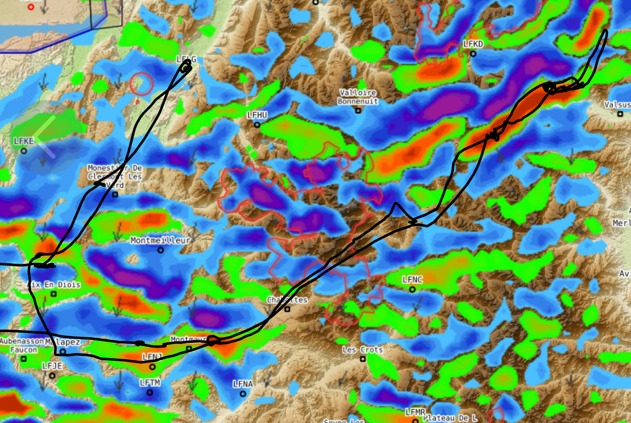
Forecast maps & Flight planning
The forecast maps contain the classic TopMeteo maps as static images.
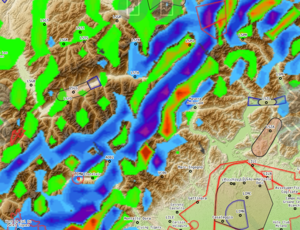
It is much more exciting to look at the topographical presentation in the flight planning tool, where you can identify each valley.
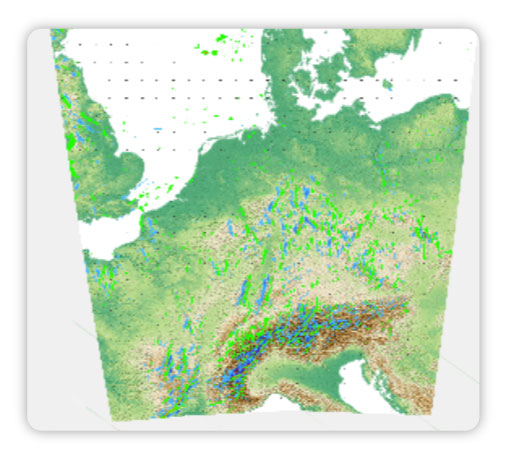
Model area
The raw data for the wave forecasts come from the German Weather Service (DWD).
https://blog.topmeteo.eu/wp-content/uploads/2022/02/Leewellen_Flugplanung.png10911425Stefan Goretzkihttps://blog.topmeteo.eu/wp-content/uploads/2018/11/LogoTrans_600-1.pngStefan Goretzki2022-02-15 16:46:362022-03-03 11:27:46TopMeteo Lee Waves for Central Europe
We can request cookies set on your device. We use cookies to communicate with you when you visit our Web sites, how you interact with us, improve your experience, and customize your relationship with our Web site.
Click on the different category headings to find out more. You can also change some of your settings. Keep in mind that blocking some types of cookies can affect your experience on our websites and the services we can offer.
Important website cookies
These cookies are essential in order to provide you with the services available on our website and to use some of their functions.
Since these cookies are essential to provide the site, you can not decline them without affecting the way our site works. You can block or delete them by changing your browser settings and forcing blocking all cookies on this site.
Google Analytics Cookies
These cookies collect information that is used either in aggregate form to understand how our website is used or how effective our marketing campaigns are, or to help us customize our website and application for you to improve your experience.
If you do not want us to track your visit to our website, you can disable tracking in your browser here:
Data Protection Policy
You can read our cookies and privacy settings in detail on our privacy policy.